|
|
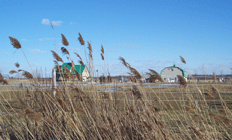
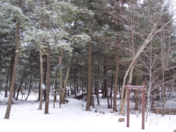
Click here to see the map of ecological sites The Bas-Richelieu is made of only 17 % of wooded land. The rest is made of plains, occupied by humans and by agriculture. There is a natural zone of interest, integrated to the world UNESCO reserve: the St-Pierre lake. The vallée-du-Richelieu is mainly constituted with plains.The plain lines the river Richelieu, and at the top of the plateaux, we can find the Montérégiennes wooded hills. There is also the Rougemont mount and the Saint-Hilaire mountain (recognized by UNESCO as a world heritage). 40 % of the river banks are kept in their natural state. The Haut-Richelieu is also made mainly of plains and agriculture cultivation. The basin land can be divided in five big types of landscapes :
|